DepthReading
Object in Focus: Antonine Wall
In an effort to share more of our favourite ancient objects from around the world, each month Ancient History Encyclopedia staff are going to take a closer look at some really amazing objects or buildings. Today’s Object in Focus is the Antonine Wall.
Although Julius Caesar led expeditions into Britain in 55-54 BCE, the first systematic conquest of the region by Rome did not occur until 43 BCE under emperor Claudius. The indigenous people of the land did not take kindly to Roman incursions as the Boudicca revolt of 60-61 CE and the Battle of Mons Graupius of 83 CE make clear.
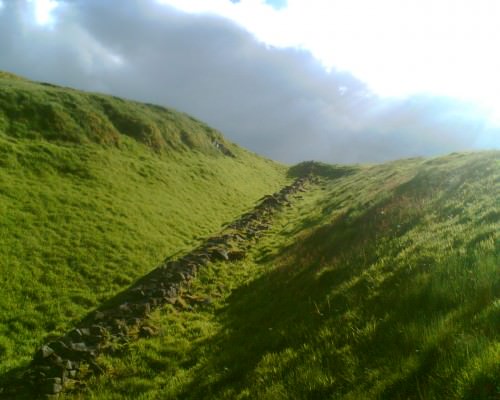
On the north-west frontier of the Roman Empire, the Antonine wall was built c. 140 CE on the orders of Antoninus Pius. The wall stretched from the Firth of Forth to the Clyde estuary. Photo © Mark Cartwright.
Under emperor Hadrian, a great wall was built in 122 CE, not so much to keep the native Picts from “civilised” Roman territories as a show of Roman strength and military might. Hadrian’s Wall is justly famous but a much lesser known structure stretches across Scotland from the Firth of Clyde to the Firth of Forth, just north of Edinburgh and Glasgow: the Antonine Wall.
This wall, built in 142 CE, was more obviously constructed as a deterrent to the Picts. The Battle of Mons Graupius was a Roman victory on the field but yielded no long-term benefits. Roman general Agricola defeated the Picts under Calgacus but was never able to hold Scotland. Scotland, in fact, remains the only country Rome engaged directly that was never conquered. Mons Graupius was still quite fresh in Roman minds when, under emperor Antoninus Pius, the Antonine Wall was constructed. It was purposefully built to monitor Pict activity and deter invasion with sixteen forts strategically placed along its line. The main objective was to extend Roman territory beyond Hadrian’s Wall and make the new boundary line clear to the Picts. It took twelve years to build and was abandoned only eight years after completion when Roman legions were pulled back to the Hadrian boundary.
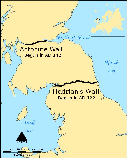
A map indicating the location and extent of the Antonine Wall (140s CE) and Hadrian’s Wall (122 CE).
Category: English
DepthReading
Key words: