• 韭家塘烽燧
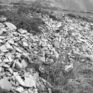
韭家塘烽燧位于原州区寨科乡东塘村韭家塘东南500 米;北纬36°17′48.7″,东经 106°26′18.8″,海拔高程1982 米;东北侧距韭家塘村600 米,南距小湾沟50 米,西北侧距寨科乡政府200 米,北距刘沟峁600 米。周围植被较好,生长有 杏、桃、榆、柳等树木。呈圆锥形,底径15 米,顶径3 米,高5 米,黄土夯筑,夯 层厚6 厘米~8 厘米。顶部南侧被挖毁。
韭家塘烽燧位于原州区寨科乡东塘村韭家塘东南500 米;北纬36°17′48.7″,东经 106°26′18.8″,海拔高程1982 米;东北侧距韭家塘村600 米,南距小湾沟50 米,西北侧距寨科乡政府200 米,北距刘沟峁600 米。周围植被较好,生长有 杏、桃、榆、柳等树木。呈圆锥形,底径15 米,顶径3 米,高5 米,黄土夯筑,夯 层厚6 厘米~8 厘米。顶部南侧被挖毁。
北塘墩墩梁烽燧位于原州区寨科乡北塘村东南100 米山顶;北纬36°19′42.6″,东经 106°22′53.5″,海拔高程2006 米;东距麻地湾100 米,西距后山沟100 米,南 距崾岘200 米,北距苋麻村100 米。地势呈东南—西北走向,东南高西北低, 东、西、北三面环沟,植被差,生长树木少。呈圆锥形,底径15 米,顶径7 米, 高4 米,黄土夯筑,夯层厚6 厘米~8 厘米。外表塌毁呈斜坡 ...
黄峁山墩墩峁烽燧位于原州区清河镇东峡村东南4 公里山梁顶端;北纬35°58′14.9″,东经 106°19′00.7″,海拔高程1983 米;南距店子河约3 公里,距固原至彭阳县任 山河公路1 公里,西北侧紧邻309 国道,北为三道沟,30 米处建有一座移动 公司铁塔。地势呈东西走向,南高北低,植被较好,生长有松、杏、桃树及黑 刺等。呈圆锥形,顶部内凹,底径20 米,顶径9 米,高10 米 ...
十里烽燧位于原州区清河镇十里村四组西200 米;北纬36°02′09.0″,东经106° 17′06.8″,海拔高程1710 米;东距北海子约1 公里,西距饮马河水库50 米, 北距饮马河沟500 米,东南侧距太白庙约2 公里。东、西、北三面环沟,植被 差,生长植物少。呈圆锥形,底径12 米,顶宽4 米,高1 米~6 米,黄土夯筑, 夯层厚6 厘米~8 厘米东侧大部分被挖毁。地面零星散布有砖瓦残 ...
饮马河烽燧位于原州区清河镇下饮马河村西北约2 公里;北纬36°02′18.6″,东经 106°16′41.9″,海拔高程1748 米;东距下饮马河沟500 米,西距小川子500 米,南距中饮马河村约2 公里,北距十里铺村约2 公里。东、西、北三面环沟, 植被较好,生长有杏树、桃树、杨树、柳树、松树等。形状呈鱼脊梁形,长13 米,宽4 米,高1 米~2.5 米,黄土夯筑,夯层厚4 厘米~8 厘米 ...
九龙山烽燧位于原州区开城镇羊坊村东200 米;北纬35°59′03.7″,东经106°16′ 26.1″,海拔高程1770 米;东距九龙山回民公墓50 米,西邻饮马河,南距福 银高速公路15 米,北为九龙山庙。周围植被差,生长树木少。呈圆锥形,底宽 20 米,顶宽8 米,残高5 米,黄土夯筑,夯层厚8 厘米~9 厘米。北侧因取土挖 毁一部分,地表遗留绳纹板瓦、筒瓦。
苏堡城址位于泾源县大湾乡(原固原县大湾乡)苏堡村北山梁上;北纬35°43′ 25.8″,东经106°15′18.5″,海拔高程2030 米;东距大湾乡政府约1000 米,南 邻红沟,西距大王殿300 米。地势呈东西走向,北高南低,植被较好,生长有 松、榆等树木。平面呈正方形,边长80 米,存高2 米,基宽3 米,黄土夯筑,夯 土层厚14 厘米~20 厘米。地面散布有大量的砖瓦和瓷片。
何堡城址位于泾源县大湾乡(原固原县大湾乡)何堡村北山梁上;北纬35°42′ 18″,东经106°16′24″,海拔高程1989 米;东邻上湾泥,南为八蛋窝子,北为 后川子,东南侧为何家堡子村。地势呈东西走向,植被较好,生长有桃、松等 树木。平面呈长方形,边长90 米,基宽约3 米,存高2.5 米,黄土夯筑,夯土 层厚14 厘米~20 厘米。地面散布有大量砖瓦和瓷片。
庙嘴子城址位于原州区清河镇长城村一组西北70 米的梁峁顶;北纬36°00′59.3″, 东经106°13′00.5″,海拔高程1808 米;东为长城村川地,南距长城村一组50 米,西距战国秦长城500 米,北距兰宜公路30 米。地势北高南低,植被差,生 长植物少。平面呈长方形,南北长50 米,东西宽40 米,面积2000 平方米。东 墙残缺,内侧残高1 米~4 米,外高3 米~6 米,基宽4 米,顶宽0 ...
八营城址位于海原县七营镇(原固原县七营乡)八营村三组东50 米;北纬36°30′ 24.9″,东经106°10′26.3″,海拔高程1455 米;东距大山洼150 米,西距清水河 约2 公里,东北为老爷山,北距八营村一组、二组200 米。地势东高西低,南 北较平坦,植被较差,生长树木较少。城址平面呈方形,边长370 米,西墙北 部修建有庙宇一座,东墙保存较好,西墙、北墙西北角、南墙西南 ...
七营城址位于海原县七营镇(原固原县七营乡)七营村;北纬36°30′10″,东经 106°09′02.7″,海拔高程1469 米;东距清水河200 米,南邻七营村,西距老街 道30 米,距银平公路300 米,北距七营中学100 米。植被较差,生长树木较 少。平面呈方形,边长140 米,墙存高4 米~6 米,基宽6 米。东北角开门,外 设瓮城。城中心一处烽火台,平面呈方形,底宽8 米,顶宽4 米,红土夯 ...
四营城址位于海原县三河镇(原固原县黑城镇)四营村;北纬36°26′11.8″,东经 106°07′30″,海拔高程1530 米;东侧山峦重叠,西为清水河谷地,南为四营 村二组,北为四营村三组。地势东高西低,南北较平坦,植被较差,山坡和河 谷种植树木较少。城址大部分被河水冲毁,平面呈方形,边长200 米,墙体黄 土夯筑,存高0.5 米~2 米,基宽6 米。地面散布有砖瓦等建筑材料。
北十里古城址始建于战国,秦汉、明代维修。又称临洮营城址。位于原州区清河镇十 里村一组;北纬36°02′58.2″,东经106°17′28.2″,海拔高程1680 米;东距清水 河150 米,南邻热电厂,西距固胡公路200 米,西北为长城梁,北侧为一条通 往清水河的田间小路,距高崖圈圈250 米(战国长城城障)。地处峡谷地带, 东西两侧环山,南北较平坦,植被较好,生长有榆、杨等树木, ...
六窑城址宋代。位于海原县三河镇(原固原县黑城镇)六窑村一组西约1500 米; 北纬36°21′37″,东经106°08′46.1″,海拔高程1501 米;东、南、北三面为古河 床,西邻清水河,西侧城墙距清水河较近,被河水冲垮。南为六窑砂石厂,距 潘炭公路约1000 米,北距唐堡村约3 公里。城墙平面呈长方形,西墙长200 米,东墙长180 米,南墙长150 米,北墙由西向东73 米,折向南20 ...
樊西堡东城址宋代始筑,明代修筑。位于张易镇黄堡村樊西堡西城址东30 米台地;北 纬35°49′02.5″,东经106°05′01.3″,海拔高程2200 米;东距黄堡八组村200 米,南距固将公路100 米,西北侧紧临塌堡子,西南侧距马莲川水库约1.5 公里。地势呈东西走向,北高南低,植被差,生长树木少。城址平面呈长方 形,南北长60 米,东西宽45 米,西、北、南墙部分已毁。墙体存高1 ...
樊西堡西城址宋代始筑,明代修筑。位于原州区张易镇黄堡村西北樊西堡山前台地 上;北纬35°49′02.5″,东经106°05′01.3″,海拔高程2200 米;东距黄堡村八组 200 米,南距固将公路100 米,西北侧紧临塌堡子,西南侧距马莲川水库约 1.5 公里,北为堡壕背。地势呈东西走向,北高南低,植被差。城址有东西两座 并列,西城平面呈长方形,有内外二重城墙。内城南北长95 米 ...
钱英堡城址宋代始筑,明代修筑。位于原州区彭堡镇河东村钱英堡村六组西50 米; 北纬36°04′09.2″,东经106°06′33.1″,海拔高程1710 米;东邻钱英堡村六组, 南距杨忠堡村一组500 米,西为头道梁,北靠刘家塬。地势东低西高,植被 差,生长植物少。城址平面呈方形,东西长200 米,南北宽200 米,墙体基宽 6 米,存高1 米~2.5 米。黄土夯筑,夯土层厚8 米~16 米。城 ...
包家堡城址宋代始筑,明代修筑。位于原州区中河乡曹河村一组堡子梁上;北纬 36°00′46.3″,东经106°07′37.1″,海拔高程1910 米;东距水河沟村三组约800 米,西为中嘴沟,南邻六盘山余脉套子沟,北侧为缓坡台地,距309 国道约 2000 米。地势呈东西走向,南高北低,坡度倾斜较大,植被差,生长着杂草。 城址依山势而建,平面呈椭圆形,分内外城。外城墙东西长80 米,南 ...
墩梁堡城址宋代始筑,明代修筑。位于原州区开城镇冯庄村一组的墩梁洼的山梁 顶端;北纬35°53′50.2″,东经106°16′27.3″,海拔高程1926 米;东距清水河 500 米,距银平公路160 米,距宝中铁路100 米;南邻小路;西距三十里铺隧 道300 米。地势呈南北走向,西高东低,植被较好,生长有杏树、榆树等。城址 平面呈方形,边长80 米,面积约6400 平方米。东墙不存,南、西 ...
天圣寨城址宋代始筑,明代修筑,又称黑马圈城。位于原州区官厅乡官厅村碌碡坪 (黑马圈)南20 米;北纬36°09′14.6″,东经106°22′23.1″。海拔高程1739 米; 东邻大沟,南为黑马圈沟,距水库约2 公里,北距黑马圈村村民马忠福家20 米,西南侧距古城梁500 米。地势呈东西走向,北高南低,植被差,生长零星 杂草。城址呈长方形,南北长200 米,东西宽160 米,面积约3 万平 ...
东河湾堡城址宋代始筑,明代修筑,又称三营,明代属开城苑,苑马营。位于原州区三 营镇老三营村五组、六组;北纬36°17′28.4″,东经106°10′00.6″,海拔高程 1520 米;东为三营村六组和大庙山,西邻清水河及老三营村二组,南、北为 三营村三组、四组,城内中心有一条南北走向的村间道路。地势东高西低,南 北较平坦,植被差,生长植物少。城址平面呈长方形,原东西长4 ...
二营城址宋代始筑,明代修筑。位于原州区头营镇二营村二组东;北纬36°11′ 49.8″,东经106°13′47.6″,海拔高程1570 米;东靠老爷山,南为南川,北接二 营村三组,城内为村民耕地。地势东高西低,南北较平坦,植被较差,生长树 木少。城址平面呈长方形,南北长280 米,东西宽190 米,墙体存高1 米~4 米,基宽4 米。黄土夯筑,夯土层厚8 厘米~20 厘米。西南两面开门。 ...
开城苑城址宋代始建,明代沿用,又称头营。位于原州区头营镇头营村三组北100 米;北纬36°10′23.3″,东经106°13′09.7″,海拔高程1580 米;东邻清水河谷, 西距胡大堡梁约2 公里,南距头营村二组150 米,北为头营村四组和东西走 向的村道路。地势东南高、西北低,植被较差,生长树木少。城址平面呈方形, 东西长260 米,南北宽260 米,南墙残缺。基宽12 米~17 米,顶 ...
铁家沟寨址宋代始筑,明代修筑。位于原州区头营镇(原杨郎乡)铁家沟村三组南 700 米的梁峁上;北纬36°10′44.6″,东经106°05′43.5″,海拔高程1791 米;南 邻方家堡,西距方家堡一组500 米,北为铁家沟。地势东低西高,东、南、北三 面环沟,植被差,生长植物少。平面呈“凸”字形,东西长300 米,南北宽80 米,开西门,设两道瓮城。东侧有两道壕沟,壕沟宽5 米~6 米, ...
黑城城址宋代始建,明代沿用。位于海原县三河镇(原固原县黑城镇)黑城村内; 北纬36°22′22″,东经106°05′23 .1″,海拔高程1524 米;东距福银高速公路 收费站约1 公里,距姚家堡村二组200 米,南邻黑城村七组、八组(商贸街), 原为黑城镇集市贸易区,西距苋麻村二组1 公里,北距苋麻河2 公里。城址 平面呈长方形,南北长800 米,东西宽520 米,墙体存高3 米~5 米, ...
米家台城址宋代,位于原州区炭山乡南坪村西南1.5 公里;北纬36°21′14.6″,东经 106°18′59.2″,海拔高程1592 米;东距砖头岗500 米,南距山台村约2 公里, 西距漫坡村约2 公里,北距米家台村约1 公里。地势呈南北走向,北高南低, 东、南、西三面环沟,植被差,生长植物少。城址平面呈长方形,面积14400 平 方米,东墙原长120 米,现残长20 米;南墙残缺,长约40 米;西 ...
红寨子城址宋筑,明代沿用。位于原州区彭堡镇姚磨村一组红寨子;北纬36°08′ 18.1″,东经106°09′28.8″,海拔高程1630 米;东邻冬至河水库,南距后堡子沟 200 米,西距西大路200 米,北距肖沟约2 公里。地势西高东低,植被差,生 长植物少。城址平面呈长方形,东西长150 米,南北宽120 米,城内有东西走 向的村道。墙体存高3 米~9 米,基宽6 米,现残存西南角。黄土 ...
毛家堡城址宋代。位于原州区炭山乡高台村西300 米;北纬36°26′51.7″,东经106° 22′33.5″,海拔高程1607 米;东距南高粱500 米,西距阳洼1 公里,南距水库 1 公里,北距虎狼台阳洼村500 米。四面环山,南、西、北三面环沟,植被差, 生长树木少,水土流失较重。城址东西长115 米,南北宽80 米,面积约1 万 平方米。西南角城墙残存20 米,北墙残存50 米,其余残缺。基 ...
老爷山城址宋代。位于原州区头营镇二营村五组东3 公里的山梁顶端;北纬36°12′ 35.5″,东经106°13′29.9″,海拔高程1670 米;东邻杨达子沟,南距石羊子村 约2 公里,西距宝中铁路800 米,北为陈家洼,东南侧距移动公司铁塔约1 公里。地势呈南北走向,植被较好,生长有柠条、山杏、山桃等。城址平面呈 长方形,南北长130 米,东西宽100 米,存高3 米~5 米,基宽6 米 ...
甘城城址宋代。位于海原县甘城乡(原固原县甘城乡)下甘村;北纬36°35′00.8″, 东经106°19′04.5″,海拔高程1518 米;东距甘城乡政府约3 公里,西距甘城 五组200 米,南距甘城村五组150 米,北距甘城村五组300 米。四面环山,植 被较差,地面有杂草,树木较少。城址平面呈正方形,边长200 米,面积约 3000 平方米。东、西、北三面墙体已毁,现存南墙长约160 米,存高4 ...
七营城耳山城址宋代。位于海原县七营镇(原固原县七营乡)盘河村东2.5 公里处清水 河与双井河交汇的峡谷口的东南山梁上;北纬36°33′21.8″,东经106°11′ 18.4″,海拔高程1602 米;西、南、北三面环沟,所处位置高出西侧清水河谷 约60 米。东邻山梁沟壑区,西距盘河村三组约3 公里,北接盘甘公路,距倪 河城700 米。地势呈南北走向,南高北低,植被较差。城址平面 ...
旧堡子城址宋代。位于原州区炭山乡南坪村五组东南1 公里;北纬36°17′01.7″,东 经106°19′06.3″,海拔高程1584 米;东距砖头岗3 公里,南邻小沟边,西距米 台山约1 公里,北距马家台村五组约1 公里。城址平面呈长方形,南北长约 500 米,东西宽100 米,面积5 万平方米。南墙残长35 米,宽8 米,顶宽1 米~1.5 米,高8 米。北墙残长20 米,基宽6 米,高1.5 米。设瓮城 ...
古城梁城址宋代。位于原州区官厅乡刘店村北300 米古城梁上;北纬36°08′54.1″, 东经106°22′12.2″,海拔高程1819 米;东邻荞花台沟,西靠马家梁,南距刘店 村二组50 米,北为黑马圈沟,东南侧为王套子。地势南高北低,东、西、北三 面环沟,植被差,生长植物少。城址依山而建,平面呈长方形,南北长100 米, 东西宽90 米,面积9000 平方米。墙体基宽10 米~15 米,顶 ...
铁家沟城址宋代。位于原州区头营镇铁家沟村三组南700 米的梁峁上;北纬36°10′ 44.6″,东经106°05′43.5″,海拔高程1791 米;西距方家堡一组500 米,南为方 家堡沟,北邻杨家沟。地势西高东低,南北二面为壕沟,植被较差,生长植物 少。城址平面呈“凸”字形,东西长300 米,南北宽80 米,开西门,设两道瓮 城。黄土夯筑,夯层厚6 厘米~10 厘米。城东侧设两道壕沟, ...
程儿山城址宋代。位于原州区清河镇程儿山村一组南500 米;北纬36°03′26.8″,东 经106°20′23.6″,海拔高程2041 米;东邻大洼,西为阎家湾,西南邻固(原)水 (泉)村道,南侧20 米处有一移动公司铁塔,北接固环公路。地势呈南北走 向,南高北低,植被较差,生长树木少。城址依地势而筑,平面呈长方形,南 北长140 米,东西宽90 米。墙体基宽12 米,外高14 米~18 米,内 ...
明川城址宋代。位于原州区河川乡明川村三组北山梁顶端;北纬35°59′48.4″,东 经106°26′40.0″,海拔高程1672 米;东距杨家沟清真寺500 米,西距明川村 委会500 米,南邻印子沟以及河川河谷川地,北靠后山峁。地势北高南低,植 被较好,山上有山杏、山桃、柠条等。城址周长210 米,面积3400 平方米,现 存南墙长30 米,北墙长45 米。城墙外高4 米~6 米,内高2 米~ ...
高平堡城址宋代。位于原州区头营镇(原杨郎乡)杨郎村;北纬36°13′33.7″,东经 106°10′44.8″,海拔高程1550 米;东距银平公路500 米,西邻杨郎村三组,南 为东西走向的柏油路,北为杨郎村一组、二组、六组。地势西高东低,南北较 平坦,植被较好,周围生长有柳树、杨树等。城址平面呈长方形,南北长700 米,东西宽650 米,城墙存高1 米~7 米,南、西、东三面开门。 ...
寨子梁城址宋代。位于原州区头营镇穆滩村一组(保家沟)南500 米的山梁顶端;北 纬36°12′22.6″,东经106°04′24.4″,海拔高程1834 米;东靠寨子梁,南为穆滩 村三组,西为李家山,北邻保家沟。地势西高东低,倾斜坡度较大,植被较好, 生长有柠条、山杏、山桃等。城址平面呈长方形,东西长80 米,南北宽50 米, 面积约4000 平方米。东、南、北三面墙已毁,西墙残长50 ...
骆驼河城址宋代。位于原州区河川乡骆驼河村二组(上店)北500 米;北纬35°59′ 26.8″,东经106°28′36.8″,海拔高程1608 米;东靠东洼梁,南距石家峡500 米, 西南侧距崾岘水库80 米,北距麦子崾岘山1 公里,西北2 米处有一移动公司 铁塔。地势呈东西走向,南北较平坦,植被较差,生长植物少,水土流失较重。 城址现为村民耕地,东西长300 米,南北宽150 米,面积约4.5 ...
杨家庄古城梁城址宋代。位于原州区开城镇寇庄村六组(杨家庄)东500 米的山梁顶端;北 纬35°57′55.4″,东经106°13′21.9″,海拔高程1888 米;东距孟家沟约500 米, 西距杨家庄河300 米,南距老庄沟2 公里,北距杨家庄河2 公里。地势呈西 南—东北走向,西南高、东北低,植被较好,生长有杏树、柠条等。城址平面 呈长方形,面积4.5 万平方米。开东、北二门,东门有瓮 ...
梁家洼城址宋代。位于原州区头营镇杨河村二组东4 公里的山梁顶端;北纬36°10′ 39.1″,东经106°19′56.9″,海拔高程1740 米;东为王家下槽子,南靠杨河村 三组,西南侧为店子沟,北邻杨河村七组。地势呈南北走向,东高西低,植被 较差,生长树木少。城址依山势而建,分内外城,面积约4 万平方米。外城呈 长方形,南北长240 米,东西宽203 米,存高1 米~3 米,基宽5 米 ...
墩墩梁城址宋代。位于原州区头营镇冯洼村西北4 公里的山梁顶端;北纬36°10′ 46.7″,东经106°17′38.6″,海拔高程1860 米;东为油房沟,西距毛家沟1.5 公 里,南邻小庄洼,北距张崖村五组1 公里。地势呈南北走向,东高西低。城址 平面呈长方形,南北长140 米,东西宽100 米,西墙已残,基宽3 米~7 米,南 北开门,城内散布有陶片。城内北有一烽火台,底宽10 米,顶宽3 ...
古城洼城址宋代。位于原州区彭堡镇曹洼村一组曹家洼北500 米;北纬36°06′50.9″, 东经106°10′57.3″,海拔高程1720 米;东距扬大沟100 米,距固胡公路1.5 公 里,南靠曹洼梁,西距银平公路500 米,北为北沟洼梁。地势南高北低,东、西、 北三面环沟,植被差,生长植物少。城址平面呈方形,边长80 米,存高0.1 米~ 2.5 米,基宽5 米,开南门,门宽6 米,黄土夯筑,夯土 ...
上店子西城址宋代。位于原州区中河乡上店子村四组西南1 公里的古城梁西山梁顶 端;北纬36°00′13.4″,东经106°03′02.9″,海拔高程1930 米;东为响水沟,西 邻城壕沟,北接水坛沟。地势呈南北走向,植被较差,生长植物少。城址南北 长80 米,北墙已毁,南墙东西残长50 米,黄土夯筑,夯土层厚8 厘米~12 厘 米。地表散布有砖瓦残块、陶片。
胡大堡城址宋代。又称熙宁寨城址。位于原州区彭堡镇吴磨村后沟北200 米;北纬 36°09′41.0″,东经106°12′14.4″,海拔高程1620 米;东邻固胡公路,南靠胡大 堡梁丘陵区,西距福银高速公路300 米,北距头营镇政府100 米,银平公路 从城北向南穿过。地势呈南北走向,南高北低,植被较好,生长有松、槐等树 木。城址依山势而筑,南高北低,平面呈“凸”字形,西北角城墙 ...
隔城子古城址宋金时期。又称三川寨城址。位于原州区彭堡镇别庄村二组;北纬36° 04′49.8″,东经106°10′46.0″,海拔高程1680 米;东邻大营河,南距别庄村三 组100 米,西距沙河子50 米,北为阎堡村。地势西高东低,植被差,生长树木 少。城址平面呈长方形,南北长880 米,东西宽324 米,墙体基宽2 米~16 米,残高2 米~10 米,黄土夯筑,夯土层厚6 厘米~8 厘米。共 ...
上店子古城址宋代。又称定川寨城址。位于原州区中河乡红崖村三组上店子水库东; 北纬36°02′15.2″,东经106°04′45.8″,海拔高程1870 米;东南侧距硝口村约 2 公里,南侧顶端为古城梁,西北距上店子水库150 米,北邻小河子,山下为 硝口河。地势呈南北走向,南高北低,植被差,生长植物少。城内北部有一条 村道,北侧有一学校,东南侧有一移动公司铁塔。城址依山势 ...
开远堡城址宋代。位于原州区开城镇三十里铺村三组南200 米;北纬35°52′44.2″,东 经106°16′08.1″,海拔高程1882 米;东距宝中铁路300 米,西距银平公路150 米,北为清水河峡谷,福银高速公路从城址西北角穿过。地势呈南北走向,南 高北低,植被较好,生长有黑刺、松树、榆树、杏树等。城址坐南面北,依山而 建,平面呈“凸”字 形,南高北低,开北 门,设瓮城。东墙 ...
张易堡城址宋代。位于原州区张易镇张易村;北纬35°49′49.0″,东经106°05′00.0″, 海拔高程1978 米;城墙东北角位于玉皇山,东邻张易村一组,南靠张易村新 修的街道,周围有学校、医院、政府机关等,距堡子山约1 公里,西为张易河, 北邻常沟。地势呈东西走向,东西较平坦。城址平面呈方形,边长500 米,基 宽16 米,东、南、西各开一门。东北角残存墙体长200 米,北 ...
马园村古城址宋代。又称高平寨城址。位于原州区头营镇马园村;北纬36°07′34.0″, 东经106°14′51.8″,海拔高程1605 米;东距宝中铁路800 米,西邻清水河,南 距沈家河四组300 米,北距马园村五组100 米。地势呈南北走向,植被较好, 生长有榆树、椿树、杨树等。平面呈长方形,东西长397 米,南北宽358 米,面 积约1.58 万平方米。开南门,门宽10 米,深11 米。有瓮 ...
黄堡村南城址宋代。位于原州区张易镇黄堡村南400 米;北纬35°49′04.7″,东经106° 05′08.3″,海拔高程1878 米;东邻大花子沟,南靠馒头梁,西为下南川,北为 张易河和庖牛沟,距固将公路约1 公里。地势呈南北走向,植被较差,生长 植物少。现存东墙、南墙、西墙,北墙已毁,东墙残长150 米,南墙残长280 米,西墙残长100 米,残高2 米~8 米,基宽3 米~16 米,黄土夯 ...
灵平寨城址宋代,俗称王浩堡。位于原州区黄铎堡镇白河村三组王浩堡村;北纬 36°14′49.3″,东经106°05′02.2″,海拔高程1683 米;东邻西大路,西靠寨子洼 山,南为南岗子,北为白河二组。地势平坦,植被较差,生长植物少。平面呈 正方形,边长380 米,城墙残高7 米,基宽2 米~6 米,南北各开一门,已毁。 城墙外侧有护城壕,宽8 米~30 米,墙体毁坏严重,黄土夯筑,夯土 ...
倪河城址宋代。位于海原县七营镇(原固原县七营乡)倪河村东南700 米处清水 河与双井河交汇的峡谷口台地上;北纬36°33′31.8″,东经106°11′11.7″,海 拔高程1437 米;东距山梁丘陵300 米,南邻盘甘公路,西距盘河村三组约3 公里,东南侧距程儿山约1 公里。地势东高西低,东、南、北三面环河,植被较 差。平面呈长方形,北偏东10°,分内外两城,外城东西长570 米,南 ...
摧沙堡城址唐宋时期,俗称焦赞城。位于原州区开城镇(原南郊乡)寇庄村鄯家堡 南100 米的台地上;北纬35°57′55.3″,东经106°10′33.7″,海拔高程1941 米; 东靠寇庄村,南距海子峡水库500 米,西邻海子峡谷口,北有一条水渠。地势 南高北低,倾斜坡度较大,植被差,生长植物少。始建于唐代,为原州西南重 要的关隘之一。平面呈长方形,南北长120 米,东西宽80 米,面积 ...
木峡关城址唐宋时期,俗称孟良城。位于原州区张易镇(原红庄乡)大店村瓦窑堡 西300 米;北纬35°54′30.7″,东经106°07′47.0″,海拔高程2170 米;东为干海 洼,南为大湾店二组,北距护林点10 米,中部有一条从大店村通往玛瑙山的 小路。地势西高东低,植被良好。平面呈长方形,南北长123 米,东西宽82 米,面积约1 万平方米,墙体残高1 米~2 米,基宽2 米~4 米,东墙 ...
北嘴城址始筑于唐代,宋、明沿用。位于海原县七营镇(原固原县七营乡)北嘴村 东300 米;北纬36°32′06.4″,东经106°09′03.1″,海拔高程1545 米;东距清 水河200 米~500 米,东北侧距盘河村二组200 米,南距清水河200 米,西距 银平公路100 米,北距盘河村一组300 米。地势平坦,植被差,生长植物少。 城址分内外两道,外城平面呈长方形,东西宽600 米,南北长650 米 ...
南沙岗子城址唐宋时期。位于原州区头营镇(原杨郎乡)马店村南沙岗子北侧塬地; 北纬36°15′11.7″,东经106°10′06.0″,海拔高程1560 米;东距银平公路80 米,南临沙岗子村50 米,西距南塬村约200 米,北为砖厂。地势西高东低,塬 地高于川地约30 米,植被较差,生长植物少。平面呈长方形,东西长120 米, 南北宽100 米,面积约1.2 万平方米,开南门。墙基宽8 米,顶宽1 ...
西宁王忻都公神道碑,简称"西宁王碑",该碑位于甘肃凉州城北15公里处的永昌镇石碑村,该碑由碑座、碑身、碑首三部分组成,碑通高5.8米,高1.6米,厚0.45米。碑正面为汉文,背面为回鹘文(蒙文),全文共32行,每行63字,碑文为元惠宗时参知政事危素撰写,由于忻都及其先祖对元室建立过卓著功勋,加之忻都之子翰栾之父忻都为西宁王,特立此碑作为纪念,这 ...
海德寺位于永登县城正北原新仓巷,这是县城内唯一残存的明代建筑。寺内原有大殿,南斗、北斗宫、马祖、山神、护法诸殿。
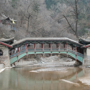
位于榆中县兴隆山。清乾隆二十八年(1763)知县唐鸣钟创建,故称"唐公桥"。屡毁屡修。嘉庆八年(1803)知县李醇和建为木结构拱桥,名"迎善桥"。光绪二十六(1900)年重建,称"云龙桥"。桥全长23.6米,跨度9米,桥面宽3米,为13踏步斜坡式。桥上建廊9间,桥头各建南、北桥亭一座,为歇山顶四角飞檐结构,东、西两侧带耳房,顶部均布疏璃瓦。保存较好 ...
甘肃渭源县城南,渭河三大源头之一的清源河上,有一座气势恢宏的木质结构的廊桥——霸陵桥。紫红色的曲拱单孔桥,像一彩虹横跨清源河上,为渭水第一桥。霸陵桥是明朝洪武元年(公元1368年)建设的,经清代同治年间、1919年、1932年、1984年四次大的维修。1918年的修建由当清源镇柯寨村何遇江、何遇海两兄弟参照兰州雷河滩卧桥式样进行改进,形成如今纯木悬 ...
黄铎堡古城唐宋时期。宋时又称平夏城址。位于原州区黄铎堡镇黄铎堡村西南200 米;北纬36°18′15.8″,东经106°03′35.4″,海拔高程1574 米;寺口子水由西向 东绕城北而过,东靠东堡村,南为黄家湾,西邻张家湾,北为潘西公路,城居 平川之上。地势平坦,植被差,生长植物少。平面略呈方形,有内外城,外城 东西长875 米,南北宽865 米,东墙、南墙、西墙保存较好,北墙 ...
瓦亭古城址始筑于汉代,唐、宋、明、清沿用。位于泾源县大湾乡瓦亭村(原固原县什 字乡瓦亭村),为泾河支流瓦亭川水和清水河的上源分水岭处,又是泾河上 源与渭河支流葫芦河的分水岭处;北纬35°41′39.9″,东经106°17′34.3″,海拔 高程1862 米~2362 米。东距甘肃平凉市45 公里,南距甘肃华亭县90 公里, 北距固原市原州区40 公里。银平公路在外城西部南北向穿 ...
城子梁城址汉代。位于原州区开城镇三十里铺村三组东100 米的清水河、赵家河交 汇的河谷台地上;北纬35°52′45.9″,东经106°16′08.8″,海拔高程1884 米;东 邻赵家河,距宝中铁路150 米,南接三十里铺城址,西靠福银高速,北为清水 河。地势呈南北走向,南高北低,植被较好,生长有松树、榆树、云杉、柳树等。 平面呈方形,边长110 米,墙体已毁,城内及周围散布有大 ...
小湾堡子梁城址汉代。位于原州区寨科乡刘沟村八组(小湾) 西500 米;北纬36°17′ 49.2″,东经106°27′01.5″,海拔高程1853 米;东距刘沟村八组500 米,南距谢 家沟300 米,西距芦苇草沟500 米,北距雷家山300 米。地势呈南北走向,北 高南低,东、南、西三面环沟,生长植物少,植被较差,水土流失严重。平面呈 长方形,面积5000 平方米,东墙残缺,内高0.5 米~4 米,外 ...
郭庙城址汉代。位于原州区开城镇郭庙村二组北60 米的山顶上;北纬35°53′ 39.1″,东经106°14′55.0″,海拔高程1908 米;东南距郭庙水库150 米,西距西 山约3 公里,西南距清真寺150 米。地势呈西南—东北走向,植被较好,生长 有榆、柳、杏等树木。平面呈方形,边长43 米,东墙残长20 米,西、南墙不存, 北墙保存较好,黄土夯筑,夯层厚8 厘米~15 厘米,有修补痕迹 ...
固原古城墙始筑于汉代,成型于明清时期,位于固原市原州区城区;北纬36°00′ 53.6″,东经106°16′32.9″,海拔高程1767 米;古城北距银川市342 公里,西距 兰州市340 公里,东南距西安市404 公里。其从创建时起,均为郡、州所在 地,现为固原市政府、原州区政府所在地。汉武帝元鼎三年(前114 年)设安 定郡,郡治高平,创修高平第一城,经东汉,北周天和四年(569 年)修 ...
战国秦长城全国重点文物保护单位。行经原州区张易镇、中河乡、开城镇、清河镇、 河川乡,长约90 公里。具体走向为:由西吉县马莲乡东北,经巴都沟进入原 州区张易镇樊西堡村南,经阎关村、红庄村,穿滴滴沟至孙家庄南;折向东, 过海子峡河到吴庄西北,又折向北经苦井、长城村,又向东北,经明庄村、海 堡村、郭庄村北侧,在此分内外两道,外域从海堡村开始,绕乔洼,经 ...
阎家庄城址始筑于战国时期,汉代与宋代复筑沿用。位于原州区清河镇长城村二 组(阎家庄)南侧;北纬36°00′26.0″,东经106°12′43.9″,海拔高程1828 米;东 距九龙山约5 公里,西距六盘山余脉猴儿牙岔约3 公里,北距固将公路200 米,西南侧距深沟村800 米。地势西南高、东北低,植被差,生长植物少。平面 呈长方形,东西长992 米,南北宽663 米,面积65.77 万平方米, ...
红庄坪遗址位于原州区三营镇孙家河村二组东北1000 米;北纬36°19′35.7″,东经 106°10′24.8″,海拔高程1574 米;东邻沙草沟,南为九条沟,西靠崖背梁,北 距孙家沟约1000 米。地势呈南北走向,东高西低,植被较好,山坡生长有柠 条等。面积约1 万平方米,文化层厚0.3 米~0.5 米,地面散布有汉代绳纹板 瓦,宋代菱格纹内壁饰蓖点纹泥质灰陶和青瓷残片、兽骨等,为汉 ...
窑儿沟峁遗址位于原州区河川乡明川村一组西北1000 米的半山坡上;北纬35°59′ 32.1″,东经106°25′00.2″,海拔高程1637 米;东距兰宜公路500 米,南距明川 村一组约1000 米,西距水沟500 米,北距阳洼山约3000 米。地势呈东西走 向,西高东低,植被较好,生长有杏、桃等树木。面积4500 平方米,地面散布 有汉代、宋代砖瓦及内饰凸圆点纹的陶片等,为汉代至宋代遗址 ...
柳沟聚落遗址位于原州区开城镇双泉村一组柳沟北侧的山坡上;北纬35°57′52.4″,东 经106°14′16.1″,海拔高程1875 米;东邻马饮河,南为阴洼,西为斜沟,北靠 阳洼。地势呈西南—东北走向,西高东低,植被较好,沟内生长有柳、杨等树 木。面积2000 平方米,文化层厚约3 米,断面可清晰地看到夯土遗迹,夯层 厚0.5 米,发现灰坑及堆积物有汉、宋、元时期的瓦片、陶瓷 ...
上蒿店遗址位于泾源县六盘山镇(原固原县蒿店乡)蒿店村西500 米;北纬35°40′ 17.6″,东经106°23′04.9″,海拔高程1728 米;南靠大山,距蒿店村五组500 米,北距银平公路200 米。地势呈南北走向,南高北低,属阴湿高寒山区,植 被较好,生长有乔木、灌木。面积3000 平方米,文化层厚1 米~2 米,地面散 布有粗绳纹灰陶片、铁块、兽骨等,为汉代遗址。
三关口遗址位于泾源县六盘山镇(原固原县蒿店乡) 三关口村西北100 米;北纬 35°40′31.3″,东经106°22′32.3″,海拔高程1698 米;东距三关口村100 米,南 距大洼山200 米,北距银平公路300 米。地势呈东西走向,南高北低,植被较 好,生长着乔灌木。面积40 万平方米,文化层厚0.3 米~0.5 米,地面散布有 粗绳纹灰陶片、兽骨等,为汉代遗址。
杨家磨遗址位于泾源县大湾乡(原固原县大湾乡)杨家磨村西的山梁上;北纬35° 42′52.7″,东经106°16′46.2″,海拔高程1980 米;东距高速公路约1200 米,南 距中庄村约1000 米,北距红沟河约1000 米。地势呈东西走向,植被较好,生 长有贝母、白芍等中草药。面积3000 平方米,文化层厚0.3 米~0.5 米,地面 散布有粗绳纹灰陶片、铁块、兽骨等,为汉代遗址。
瓦渣梁遗址位于原州区原开城镇政府西北500 米的缓坡地带;北纬35°51′40″,东 经106°15′15″,海拔高程1995 米;东为银平公路,南邻开城长虫梁遗址,西 为罗家庄沟,北侧有一条东西走向的开城至罗家庄村道路。地势呈西南—东 北走向,东北高,西南低,较平坦,植被较好。长约800 米,宽200 米~450 米, 地埂坡面堆放汉代粗细绳纹筒瓦、板瓦、陶片等,为汉代遗址。
东海子遗址位于原州区开城镇马场村二组东约2000 米;北纬35°52′03.9″,东经 106°20′13.6″,海拔高程1939 米;东邻彭阳县古城镇海口村,南接凉马台、大 岔沟,西为马场村二组,有一条通向三十里铺的柏油路,北靠山梁。地势呈 西北—东南走向,植被较差,山坡为灰砂岩,风化较重,流沙覆盖。遗址由两 部分构成:第一部分为海子,海子平面呈不规则形,东西长约3000 米, ...
吴家庄南遗址(董家河)位于原州区头营镇吴家庄村南300 米;北纬36°14′18.1″,东经106°11′ 49.9″,海拔高程1580 米;东靠上梁,南邻董家沟,西距宝中铁路200 米,北为 上洼村。地势呈南北走向,东高西低,植被较差,生长植物少。面积约4500 平 方米,文化层厚1.5 米,在断面上可看到窑洞式房址、灶坑、灰坑,地表散布 有砖、瓦、泥质灰陶片,为汉代遗址。
吴家庄东遗址(崾岘湾)位于原州区头营镇蒋河村二组吴家庄东山洼山梁的东坡上;北纬36° 14′13.4″,东经106°11′48.7″,海拔高程1570 米;东靠上梁,南邻董家河,西距 宝中铁路100 米,北为上洼村。地势呈南北走向,东高西低,植被较差,生长 植物少。面积约2 万平方米,分为崾岘湾和董家河两部分,地面散布有大量 泥质灰陶片以及少量砖、瓦残块,陶器器形有罐、壶、 ...
南城拐子遗址位于原州区黄铎堡镇南城村西50 米;北纬36°17′32.9″,东经106°02′ 33.1″,海拔高程1688 米;东距扬水站300 米,南为黄湾村六组,西邻墩墩梁, 北为大河(又称寺口子河)。地势呈南北走向,西高东低,植被较好,生长有 杏树、桃树等。面积约2.5 万平方米,地面散布有汉代泥质灰陶片与绳纹板 瓦、砖等,属汉代聚落遗址。
政府街遗址位于原州区政府西街区委院内固原古城墙内墙西南端;北纬36°00′ 14.9″,东经106°16′46.5″,海拔高程1753 米左右;东距清水河约600 米,距东 岳山约1500 米,南距政府西街约50 米,西邻政府巷,北邻向阳院小区。地势 西高东低。面积约5000 平方米,地面存有大量灰坑,出土有绳纹板瓦、筒瓦 等建筑材料和动物骨骼,为汉代遗址。1992 年在施工过程中被发 ...
中山南街遗址位于原州区六小院内固原内城墙内侧10 米;北纬36°00′10.9″,东经 106°16′53.1″,海拔高程1753 米;东距中山南街40 米,南邻南关街,西距西 湖公园500 米,北为政府街。地势西高东低。出土大量绳纹陶片,绳纹板瓦、 筒瓦,动物骨骼,灰坑以及汉代半两钱币等,为汉代遗址。1993 年在施工过 程中被发现。
固原文化东街遗址位于原州区财政局院内;北纬36°00′3.2″,东经106°16′54.8″,海拔高程 1752 米;东距中山街40 米,南距文化东街50 米,西邻梅圆饭店。地势西高 东低,植被较好,生长有松树等。面积约5000 平方米,出土大量绳纹板瓦、筒 瓦、云雷纹瓦当、动物骨骼以及汉代水井、半两钱币等,为汉代遗址。1998 年 施工过程中被发现。
长城东路遗址位于原州区第二中学院内;北纬36°00′01.2″,东经106°16′36.2″,海拔高 程1747 米;东靠上店坊清真寺,南邻银平公路,西接气象站,北有烧人沟,现 已填平建楼,西北侧为西湖公园。地势西高东低,植被较好,生长有松、柳等 树木。面积1600 平方米,文化层厚2 米,地表留有深2 米、直径约1 米的圆 形陶窖,还有大量绳纹板瓦、云雷纹瓦当和五角形陶排水套 ...
白家梁遗址位于原州区开城镇彭庄村四组北白家梁顶;北纬35°55′56.4″,东经 106°12′15.3″,海拔高程2009 米;东北为丘陵,南为彭庄水沟,西有一条通往 山顶的田间小路,北为杨家山。地势呈西南—东北走向,西南高东北低,植 被较好,生长有杨树、柠条等。东西长约300 米,南北宽50 米,面积约1.5 万 平方米,地表遗留有大量的砖块、石块、板瓦、筒瓦等建筑材料及灰 ...
玛瑙山遗址位于原州区开城镇寇庄村九组(鄯家堡) 南200 米的玛瑙山北坡(阴 洼);北纬35°57′19.0″,东经106°10′35.1″,海拔高程2037 米;西南侧距海子 峡水库约1200 米,西北为红土湾,北距鄯家堡村400 米。地势呈东南—西北 走向,南高北低,植被较好,生长有松、榆等树木。面积1 万平方米,曾出土汉 代铜镜,地面散布有泥质陶片及砖、瓦残片,纹饰有绳纹、篮纹。 ...
杨家磨烽火台位于泾源县大湾乡(原固原县大湾乡)杨家磨村西2 公里山梁的顶端; 北纬35°42′51.2″,东经106°16′48.3″,海拔高程2130 米;东邻泾河系大湾 河,有一小溪由西向东南流入泾河,南接喜鹊湾,西距苏堡村约1 公里。周 围植被差,生长植物少。呈圆锥(台)形,底径18 米,顶径1~2 米,存高3 米, 黄土夯筑,夯层厚15 厘米~20 厘米。地面散布有瓦片、瓷片等。
瓦亭烽火台位于泾源县六盘山镇(原固原县什字路乡) 瓦亭村西2 公里山梁的顶 端;北纬35°41′26.4″,东经106°17′39.1″,海拔高程2180 米;东距瓦亭河谷 约1.5 公里,南距五里村500 米,西为亮天。周围植被较差,树木较少。呈圆 锥(台)形,底径17.5 米,存高3 米,黄土夯筑,夯层厚8 厘米~12 厘米。地面 散布有少量瓷片。
三十里铺烽火台位于原州区开城镇冯庄村一组墩梁洼山梁的顶端;北纬35°53′50.2″,东 经106°16′27.3″,海拔高程1926 米;东距清水河500 米、距银平公路160 米, 距宝中铁路100 米,南侧有一条小路通过,西距墩梁堡城址15 米、距三十里 铺隧道300 米,东南角建有一移动公司铁塔。周围植被较好,生长有杏树、榆 树等。呈圆锥(台)形,底径18 米,顶径4 米,高8 米,黄 ...
大湾烽火台位于泾源县大湾乡(原固原县大湾乡)大湾村西2.5 公里山梁的顶端; 北纬35°43′41.8″,东径106°15′43.0″,海拔高程2020 米;东为水滩,有一小溪 由西向东南流入泾河,西靠田家洼,北接白石头湾。周围植被较差,生长树 木较少。呈圆堆(台)形,底径18 米,存高3.5 米,黄土夯筑,夯层厚8 厘米~ 12 厘米。
牛营子烽火台位于泾源县大湾乡(原固原县大湾乡)牛营子村西2 公里山梁的顶端; 北纬35°45′56.9″,东经106°15′49.3″,海拔高程2230 米;东邻牛营子河,西南 侧为泾河支流,北为西洼沟。周围植被差,生长树木少。呈圆锥(台)形,底径 18 米,存高3 米,黄土夯筑,夯层厚8 厘米~12 厘米。地面散布有瓷片。
薛家崾岘烽火台位于原州区官厅乡石庄村东1 公里薛家崾岘北;北纬36°06′58.4″,东经 106°21′47.4″,海拔高程1903 米;东距刘店村约1 公里,西靠关山,东南侧距 固寨公路20 米,北邻大坝沟。周围植被较好,地埂上生长有柠条、杂草等。由 于长期风雨侵蚀,呈圆锥(台)形,底径8 米,顶径1.5 米,高4 米,黄土夯筑, 夯层厚12 厘米~16 厘米。
庙墩墩烽火台位于原州区官厅乡官厅村碌碡坪(黑马圈)北30 米山的南坡;北纬36° 09′18.3″,东经106°22′20.6″,海拔高程1758 米;东邻大沟,西为?砣?
上洼梁烽火台位于原州区官厅乡官厅村套子沟西1 公里的山梁顶端;北纬36°08′ 36.4″,东经106°24′17.1″,海拔高程1922 米;东邻梁壕沟,西距套子村0.5 公 里,北接引水工程水池,东南侧距高庄村1 公里。南北环沟,周围植被较好, 生长有山桃、山杏、黑刺、柠条等。呈圆锥形,底径16 米,顶径4 米,高9 米。 外有坞墙两道,壕沟两条。内侧坞墙边长50 米,基宽6 米,顶 ...
墩湾烽火台位于原州区河川乡海坪村五组(墩湾)村东30 米的山梁顶端;北纬35° 59′31.8″,东经106°23′47.3″,海拔高程1787 米;东距洞子沟500 米,西距水 塔沟500 米,南距南山梁500 米,北距东梁峁200 米。两侧为山坡,周围植被 较好,生长有山桃、山杏、柠条、苜蓿等。形状呈方形,底宽11 米,顶宽6 米, 残高6 米,黄土夯筑,夯层后8 厘米~13 厘米。烽火台四周筑 ...
黄峁山烽火台位于原州区清河镇峡口村东南4 公里山梁顶端;北纬35°58′11.5″,东经 106°18′24.7″,海拔高程1957 米;东距固原野生动物养殖厂2 公里,南邻固 原—古城公路,西距青石峡水库0.5 公里,北距黄峁山太白庙1 公里。周围 植被较好,生长植物有山杏、山桃、黑刺、柠条等。呈圆锥(台)形,底径9 米, 顶径8 米,高3 米,黄土夯筑,夯层厚7~8 厘米、15 厘米。 ...
万崖子烽火台位于原州区头营镇大疙瘩村一组(万崖子)南400 米;北纬36°09′45.9″, 东经106°07′23.5″,海拔高程1691 米;东为西大路,西距臭水沟村1.5 公里, 北邻万崖沟。周围植被差,生长植物少。呈圆锥形,底径16 米,顶径2.5 米, 高6 米,黄土夯筑,夯层6 厘米~10 厘米。地面零星散布有砖瓦、瓷片。
东塬墩墩烽火台位于原州区三营镇东塬村二组西3 公里;北纬36°16′33.5″,东经106° 11′35.8″,海拔高程1740 米;东邻南套,西接马路村五组,北距东塬村四组 2.5 公里。周围植被较好,生长有柠条、山杏、山桃等。形状呈圆锥形,底径16 米,顶径2.5 米,高8 米,黄土夯筑,夯层厚6 厘米~8 厘米。四周有平台,平台 直径26 米,高4 米,平台外设壕沟,壕沟宽7 米。壕沟外 ...
上洼烽火台位于原州区头营镇(原杨郎乡)马店村一组(上洼)东300 米;北纬36° 14′58.7″,东经106°11′26.8″,海拔高程1580 米;东靠崖背梁,西距铁路200 米,南为吴家庄,北为马路沟。周围植被较好,生长有柠条、山杏、山桃、苜蓿 等。边长10 米,残高1 米~3 米,黄土夯筑,夯层厚6 厘米~8 厘米。烽火台外 有坞墙,坞墙东西长40 米,南北宽40 米,基宽2 米~6 米。开 ...
坪乐烽火台位于原州区头营镇坪乐村四组北1 公里的平埫台地边;北纬36°13′ 15.7″,东经106°15′44.1″,海拔高程1630 米;东邻坪乐村三组,西靠大北山 村,南接北堡子,北为黑洞沟。周围植被较差,生长树木少。呈圆锥(台)形,底 径35 米,顶径3.5 米,高16 米,黄土夯筑。